
Everglades Depth Estimation Network (EDEN) for Support of Biological and Ecological Assessments
Cape Sable Seaside Sparrow (CSSS) Viewer
 Cape Sable Seaside Sparrow (CSSS) Viewer
The Cape Sable seaside sparrow (CSSS; Ammospiza maritima mirabilis) was originally listed as an endangered species in 1967. The current distribution is restricted to parts of Everglades National Park and Big Cypress National Preserve in Florida. There are six subpopulation areas, designated A through F.
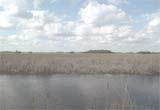
Changes in habitat and hydrology threaten the CSSS with extinction, and efforts to protect and increase populations have been of limited success. The sparrows build their nests on the ground and up to 17 centimeters above ground in mixed marl prairie. For successful nesting, these short-hydroperiod prairies must remain mostly dry from March through July.
The Everglades Depth Estimation Network (EDEN) provides daily water-depth surfaces for the freshwater Everglades from 1991 to present. The CSSS Viewer was developed to use these surfaces to estimate water depths in CSSS habitat on a daily basis.
Everglades restoration decision-makers can use the CSSS Viewer to assess habitat condition, manage water movement, and reduce flooding in these areas during the nesting season.
Please send any questions or comments to the EDEN Data Help.
The CSSS Water-Depth Maps show daily EDEN water-depth surfaces on the 400m grid using the HAED digital elevation model (Jones et al., 2011).
Small portions of subpopulation areas B, C, and D are outside the EDEN model domain. Statistics calculated here only include areas within the domain.
Note that subpopulation A1 is a subarea contained completely within subpopulation AX.

| For 2026-07-09 | ||
| ≥40% dry | DHP | |
| AX | 117 days | 14 days |
| A1 | 129 days | 2 days |
| B | 115 days | 16 days |
| C | 131 days | 0 days |
| D | 69 days | 62 days |
| E | 129 days | 2 days |
| F | 131 days | 0 days |
Summary statistics for the Cape Sable seaside sparrow subpopulation areas. A CSV file of these statistics used in this application can be downloaded here.
Popup statistics graphs available: click column headings (e.g., "≥ 40") to view.
Percent of subpopulation areas dry during nesting season (March 1 through July 15) for at least 40 and 90 consecutive days.
| AX Nesting | A1 Nesting | B Nesting | C Nesting | D Nesting | E Nesting | F Nesting | ||||||||
|---|---|---|---|---|---|---|---|---|---|---|---|---|---|---|
| Year | ≥ 40 | ≥ 90 |
≥ 40 | ≥ 90 |
≥ 40 | ≥ 90 |
≥ 40 | ≥ 90 |
≥ 40 | ≥ 90 |
≥ 40 | ≥ 90 |
≥ 40 | ≥ 90 |
| 1991 | 90.1% | 1.4% | 100% | 5.5% | 100% | 32.3% | 100% | 82.6% | 97.2% | 19.5% | 100% | 27.9% | 100% | 78.8% |
| 1992 | 65.7% | 41% | 100% | 74.5% | 95.2% | 90.7% | 100% | 100% | 97.6% | 80.9% | 100% | 99.1% | 100% | 100% |
| 1993 | 5.7% | 0.4% | 0% | 0% | 78.1% | 60.1% | 98.7% | 97.5% | 72.8% | 58.5% | 91.8% | 62.4% | 100% | 100% |
| 1994 | 34.2% | 8% | 53.9% | 10.5% | 94.6% | 73% | 96.2% | 82.2% | 56.5% | 22.8% | 99.7% | 70.2% | 100% | 100% |
| 1995 | 0% | 0% | 0% | 0% | 70.4% | 44.7% | 98.7% | 89.8% | 58.1% | 20.3% | 46.2% | 19.1% | 100% | 99.3% |
| 1996 | 37.1% | 9.8% | 80.8% | 22.1% | 79.1% | 42% | 100% | 43.2% | 88.2% | 34.1% | 82% | 48.9% | 100% | 86.8% |
| 1997 | 34.3% | 21.4% | 62.7% | 34.9% | 86.5% | 55.1% | 100% | 81.4% | 94.3% | 70.7% | 98.6% | 35.4% | 100% | 100% |
| 1998 | 38.2% | 8.6% | 85.9% | 27.8% | 87.5% | 47.5% | 98.3% | 95.3% | 58.1% | 17.5% | 95.8% | 44.7% | 100% | 100% |
| 1999 | 50.8% | 15.2% | 100% | 32.8% | 100% | 71% | 100% | 100% | 100% | 72% | 100% | 79.6% | 100% | 100% |
| 2000 | 46.3% | 21.4% | 100% | 60.2% | 90.2% | 73.4% | 100% | 93.6% | 80.1% | 50.4% | 97.2% | 64.6% | 100% | 100% |
| 2001 | 87.6% | 53% | 100% | 100% | 100% | 99.9% | 100% | 100% | 100% | 89.8% | 100% | 99.4% | 100% | 100% |
| 2002 | 78.7% | 42.3% | 100% | 92% | 99.7% | 62.3% | 100% | 100% | 100% | 71.1% | 98.9% | 58.8% | 100% | 100% |
| 2003 | 51.7% | 6.1% | 95% | 10.5% | 41.2% | 25.5% | 96.6% | 51.3% | 34.6% | 24% | 64.3% | 23.2% | 100% | 7.3% |
| 2004 | 62.7% | 46% | 100% | 95.8% | 100% | 92.9% | 100% | 100% | 98.4% | 85% | 100% | 89.3% | 100% | 100% |
| 2005 | 66.6% | 41.3% | 100% | 93% | 99.7% | 80.7% | 100% | 100% | 78.9% | 62.2% | 100% | 92.9% | 100% | 100% |
| 2006 | 65.2% | 48.4% | 100% | 100% | 98.5% | 44.4% | 100% | 92.8% | 85.8% | 63% | 100% | 63.2% | 100% | 100% |
| 2007 | 44% | 16% | 97% | 32.2% | 90.4% | 36.1% | 100% | 93.6% | 71.5% | 22.8% | 97.8% | 36.5% | 100% | 100% |
| 2008 | 71.2% | 38.4% | 100% | 88.2% | 100% | 70.9% | 100% | 99.2% | 93.9% | 31.7% | 100% | 73.4% | 100% | 100% |
| 2009 | 79.1% | 32.1% | 100% | 77.3% | 100% | 65.9% | 100% | 83.5% | 100% | 27.2% | 100% | 16.6% | 100% | 100% |
| 2010 | 45.7% | 19.3% | 97.5% | 46.1% | 77.9% | 58.4% | 100% | 94.1% | 56.1% | 32.5% | 84.6% | 65% | 100% | 58.9% |
| 2011 | 79.5% | 69.2% | 100% | 100% | 100% | 99.1% | 100% | 100% | 100% | 93.5% | 100% | 100% | 100% | 100% |
| 2012 | 64.9% | 20.8% | 100% | 57.5% | 98.3% | 23.4% | 100% | 6.4% | 82.9% | 0.8% | 99.4% | 8.2% | 100% | 36.4% |
| 2013 | 50.7% | 2.4% | 100% | 5.9% | 74.9% | 13.4% | 100% | 7.2% | 65.9% | 2% | 93.4% | 0.2% | 100% | 100% |
| 2014 | 74.2% | 36.1% | 100% | 77.9% | 94.9% | 68.6% | 100% | 100% | 91.1% | 55.7% | 99.2% | 74.1% | 100% | 100% |
| 2015 | 59.3% | 47.9% | 100% | 100% | 96% | 30.8% | 100% | 97.5% | 87.8% | 6.5% | 100% | 45.1% | 100% | 100% |
| 2016 | 14.1% | 5.7% | 54.1% | 21.9% | 69.6% | 32.9% | 46.6% | 3% | 11% | 3.7% | 19.4% | 6% | 2.6% | 0% |
| 2017 | 62.8% | 47.2% | 100% | 98.9% | 79.8% | 69.5% | 100% | 100% | 76% | 62.6% | 92.3% | 79% | 100% | 100% |
| 2018 | 58.4% | 1.5% | 100% | 2.3% | 78.7% | 18.4% | 100% | 12.3% | 77.2% | 5.7% | 85.6% | 5.5% | 100% | 78.8% |
| 2019 | 45.8% | 34.1% | 99.8% | 84% | 62.6% | 55.5% | 100% | 100% | 61.4% | 41.1% | 87.6% | 79.9% | 100% | 100% |
| 2020 | 74.8% | 35.4% | 100% | 54.7% | 87.3% | 24.5% | 100% | 16.1% | 80.5% | 14.2% | 100% | 26.5% | 100% | 10.6% |
| 2021 | 69.2% | 36.9% | 100% | 99% | 80.4% | 41.1% | 100% | 25.8% | 71.5% | 31.3% | 79.6% | 27% | 100% | 87.4% |
| 2022 | 30.9% | 13.8% | 93% | 48.2% | 45.9% | 34.5% | 97% | 19.1% | 43.9% | 11% | 32.6% | 7.1% | 100% | 43% |
| 2023 | 37.8% | 3.6% | 96.4% | 10.9% | 79.3% | 17.6% | 93.2% | 54.2% | 38.6% | 0.8% | 41.7% | 14.9% | 96.7% | 9.3% |
| 2024 | 6.9% | 0% | 27% | 0% | 36.7% | 5.1% | 88.6% | 3.8% | 8.1% | 0% | 7.1% | 0% | 80.8% | 0% |
| 2025 | 61.5% | 41.4% | 100% | 97.9% | 89% | 30.9% | 100% | 77.5% | 82.9% | 22.8% | 76.6% | 26.5% | 100% | 100% |
Percent of subpopulation areas with discontinuous hydroperiods during the calendar year of 0 to 89, 90 to 210, and > 210 days.
| AX Annual | A1 Annual | B Annual | C Annual | D Annual | E Annual | F Annual | |||||||||||||||
|---|---|---|---|---|---|---|---|---|---|---|---|---|---|---|---|---|---|---|---|---|---|
| Year | 0 to 89 | 90 to 210 | ≥ 211 |
0 to 89 | 90 to 210 | ≥ 211 |
0 to 89 | 90 to 210 | ≥ 211 |
0 to 89 | 90 to 210 | ≥ 211 |
0 to 89 | 90 to 210 | ≥ 211 |
0 to 89 | 90 to 210 | ≥ 211 |
0 to 89 | 90 to 210 | ≥ 211 |
| 1991 | 0% | 24.8% | 75.2% | 0% | 61.5% | 38.5% | 27.4% | 50.7% | 21.9% | 91.9% | 8.1% | 0% | 12.6% | 57.7% | 29.7% | 35.7% | 59.4% | 4.9% | 94.7% | 5.3% | 0% |
| 1992 | 0% | 38.4% | 61.6% | 0% | 88% | 12% | 26.8% | 56.9% | 16.4% | 91.5% | 8.5% | 0% | 32.9% | 44.3% | 22.8% | 32.6% | 67.2% | 0.2% | 100% | 0% | 0% |
| 1993 | 0% | 0.6% | 99.4% | 0% | 0% | 100% | 34.8% | 26.9% | 38.3% | 44.1% | 54.7% | 1.3% | 8.5% | 52.4% | 39% | 31.2% | 34.5% | 34.3% | 92.7% | 7.3% | 0% |
| 1994 | 0% | 6.9% | 93.1% | 0% | 14.1% | 85.9% | 20.9% | 52.2% | 26.9% | 16.1% | 80.1% | 3.8% | 3.7% | 51.6% | 44.7% | 4.9% | 75.4% | 19.7% | 68.2% | 31.8% | 0% |
| 1995 | 0% | 0% | 100% | 0% | 0% | 100% | 6.4% | 31.2% | 62.4% | 8.5% | 50% | 41.5% | 0% | 5.7% | 94.3% | 0% | 5.5% | 94.5% | 49.7% | 27.2% | 23.2% |
| 1996 | 0% | 0.2% | 99.8% | 0% | 0% | 100% | 32.8% | 27% | 40.1% | 57.2% | 41.5% | 1.3% | 5.7% | 52.4% | 41.9% | 17.4% | 26.3% | 56.3% | 88.7% | 11.3% | 0% |
| 1997 | 0% | 6% | 94% | 0% | 20.2% | 79.8% | 18.7% | 30.8% | 50.5% | 14.4% | 85.6% | 0% | 3.7% | 54.9% | 41.5% | 7.4% | 28.2% | 64.4% | 88.7% | 11.3% | 0% |
| 1998 | 0% | 2.2% | 97.8% | 0% | 6.3% | 93.7% | 25.1% | 13.8% | 61.1% | 59.3% | 33.1% | 7.6% | 6.5% | 19.9% | 73.6% | 14.6% | 16.5% | 69% | 94.7% | 5.3% | 0% |
| 1999 | 0% | 0.2% | 99.8% | 0% | 0% | 100% | 24.5% | 22.1% | 53.4% | 8.5% | 80.1% | 11.4% | 2.8% | 29.3% | 67.9% | 2.7% | 31% | 66.3% | 55% | 44.4% | 0.7% |
| 2000 | 1.3% | 14.5% | 84.2% | 3.2% | 43% | 53.7% | 32.7% | 27.7% | 39.6% | 8.1% | 91.9% | 0% | 4.1% | 45.9% | 50% | 19.4% | 29.3% | 51.3% | 94.7% | 5.3% | 0% |
| 2001 | 0% | 41.7% | 58.3% | 0% | 97.1% | 2.9% | 25.2% | 63.8% | 11% | 8.1% | 91.9% | 0% | 3.7% | 78.5% | 17.9% | 13.9% | 80.1% | 6% | 83.4% | 16.6% | 0% |
| 2002 | 0% | 11.2% | 88.8% | 0% | 36.2% | 63.8% | 26.7% | 29.7% | 43.6% | 23.3% | 76.7% | 0% | 9.3% | 52.4% | 38.2% | 13.2% | 25.1% | 61.8% | 84.1% | 15.9% | 0% |
| 2003 | 0% | 10% | 90% | 0% | 32% | 68% | 21.3% | 25.2% | 53.5% | 8.9% | 80.1% | 11% | 4.1% | 41.9% | 54.1% | 6.3% | 25.2% | 68.5% | 6% | 66.9% | 27.2% |
| 2004 | 0% | 9.3% | 90.7% | 0% | 29% | 71% | 36% | 34.2% | 29.7% | 41.1% | 58.9% | 0% | 31.3% | 31.3% | 37.4% | 19.9% | 32.3% | 47.8% | 88.1% | 11.9% | 0% |
| 2005 | 0% | 12.3% | 87.7% | 0% | 34.5% | 65.5% | 23.3% | 58.1% | 18.6% | 2.5% | 96.6% | 0.8% | 2.8% | 59.3% | 37.8% | 3% | 58.3% | 38.7% | 3.3% | 96.7% | 0% |
| 2006 | 0% | 13.1% | 86.9% | 0% | 42.9% | 57.1% | 29.1% | 47.2% | 23.7% | 85.2% | 14.8% | 0% | 25.6% | 45.5% | 28.9% | 29.6% | 32.3% | 38.1% | 100% | 0% | 0% |
| 2007 | 12.6% | 25.1% | 62.3% | 33.7% | 56.4% | 9.9% | 29.3% | 40.9% | 29.8% | 64.8% | 35.2% | 0% | 5.3% | 58.9% | 35.8% | 37.3% | 33.4% | 29.3% | 100% | 0% | 0% |
| 2008 | 0% | 50.4% | 49.6% | 0% | 100% | 0% | 29.5% | 55.9% | 14.6% | 3.4% | 96.6% | 0% | 3.7% | 73.2% | 23.2% | 1.6% | 96.1% | 2.4% | 15.9% | 84.1% | 0% |
| 2009 | 0.4% | 12.7% | 86.9% | 0% | 40.8% | 59.2% | 23.3% | 33.2% | 43.5% | 2.5% | 62.7% | 34.7% | 3.7% | 26.4% | 69.9% | 5.2% | 24.3% | 70.5% | 49.7% | 50.3% | 0% |
| 2010 | 0% | 23.3% | 76.7% | 0% | 64.2% | 35.8% | 27.2% | 26.7% | 46.1% | 10.2% | 89% | 0.8% | 3.3% | 38.2% | 58.5% | 10.2% | 38.6% | 51.3% | 18.5% | 81.5% | 0% |
| 2011 | 7.8% | 30.4% | 61.8% | 25% | 69% | 6.1% | 32.3% | 42.1% | 25.6% | 30.9% | 69.1% | 0% | 13.8% | 56.1% | 30.1% | 27.1% | 58% | 14.9% | 95.4% | 4.6% | 0% |
| 2012 | 0% | 12.9% | 87.1% | 0% | 45.7% | 54.3% | 17.9% | 20% | 62.1% | 0.8% | 23.3% | 75.8% | 0.4% | 6.5% | 93.1% | 0.2% | 17.2% | 82.6% | 0.7% | 73.5% | 25.8% |
| 2013 | 0% | 7% | 93% | 0% | 27% | 73% | 20.8% | 20.8% | 58.5% | 1.7% | 56.4% | 41.9% | 2% | 23.2% | 74.8% | 1.4% | 17.4% | 81.2% | 2% | 91.4% | 6.6% |
| 2014 | 2% | 16.6% | 81.4% | 6.3% | 47.2% | 46.5% | 39.9% | 16.8% | 43.3% | 37.7% | 58.5% | 3.8% | 5.7% | 25.2% | 69.1% | 24.6% | 21.5% | 53.9% | 74.2% | 25.8% | 0% |
| 2015 | 12.2% | 34% | 53.8% | 35.2% | 64.6% | 0.2% | 31.3% | 42.2% | 26.5% | 79.7% | 20.3% | 0% | 14.6% | 50.4% | 35% | 34.3% | 51.3% | 14.4% | 100% | 0% | 0% |
| 2016 | 0% | 3.5% | 96.5% | 0% | 13.5% | 86.5% | 18.3% | 17.9% | 63.8% | 0.8% | 8.1% | 91.1% | 0.4% | 3.3% | 96.3% | 0% | 6.7% | 93.3% | 0% | 28.5% | 71.5% |
| 2017 | 0% | 17% | 83% | 0% | 55.2% | 44.8% | 9.4% | 43.7% | 47% | 0.4% | 96.6% | 3% | 0% | 30.9% | 69.1% | 0% | 42.5% | 57.5% | 0% | 100% | 0% |
| 2018 | 0% | 12.9% | 87.1% | 0% | 49.7% | 50.3% | 18.6% | 17.3% | 64.1% | 2.5% | 19.1% | 78.4% | 1.6% | 2.8% | 95.5% | 0.3% | 7.1% | 92.6% | 10.6% | 77.5% | 11.9% |
| 2019 | 10% | 16.1% | 73.9% | 36% | 46.1% | 17.9% | 22.9% | 26.6% | 50.5% | 14% | 55.9% | 30.1% | 2.8% | 24.8% | 72.4% | 10% | 29% | 61% | 49% | 51% | 0% |
| 2020 | 0% | 27.3% | 72.7% | 0% | 81% | 19% | 7.4% | 33% | 59.6% | 0.4% | 33.9% | 65.7% | 0% | 8.5% | 91.5% | 0% | 24.1% | 75.9% | 0% | 86.1% | 13.9% |
| 2021 | 4.1% | 11.4% | 84.6% | 16.2% | 35.8% | 48% | 17.8% | 14.8% | 67.4% | 0.8% | 14% | 85.2% | 0% | 3.7% | 96.3% | 0% | 16.1% | 83.9% | 0% | 68.2% | 31.8% |
| 2022 | 0% | 11% | 89% | 0.2% | 42.5% | 57.3% | 19.3% | 20.4% | 60.3% | 3% | 17.4% | 79.7% | 2% | 1.6% | 96.3% | 1.1% | 7.8% | 91.1% | 23.2% | 44.4% | 32.5% |
| 2023 | 0% | 4.5% | 95.5% | 0% | 17.9% | 82.1 | 10.7% | 16.1% | 73.2% | 0.8% | 27.1% | 72% | 0% | 3.7% | 96.3% | 0% | 8.3% | 91.7% | 3.3% | 18.5% | 78.1% |
| 2024 | 0% | 0% | 100% | 0% | 0% | 100% | 8.9% | 15.7% | 75.4% | 0.8% | 16.9% | 82.2% | 0% | 0.8% | 99.2% | 0% | 1.6% | 98.4% | 15.2% | 47.7% | 37.1% |
| 2025 | 7.4% | 23.1% | 69.5% | 29.3% | 65.9% | 4.8% | 25.3% | 28.4% | 46.3% | 36.9% | 59.3% | 3.8% | 3.7% | 32.9% | 63.4% | 18.5% | 40.3% | 41.2% | 89.4% | 10.6% | 0% |
Mean four-year hydroperiod (labeled by the year following a four year window, e.g., "1995" represents the span 1991-1994) and standard deviation.
| AX | A1 | B | C | D | E | F | ||||||||
|---|---|---|---|---|---|---|---|---|---|---|---|---|---|---|
| Year | Mean 4YHP | Mean 4YHP SD |
Mean 4YHP | Mean 4YHP SD |
Mean 4YHP | Mean 4YHP SD |
Mean 4YHP | Mean 4YHP SD |
Mean 4YHP | Mean 4YHP SD |
Mean 4YHP | Mean 4YHP SD |
Mean 4YHP | Mean 4YHP SD |
| 1995 | 285 days | 59 days | 256 days | 75 days | 153 days | 28 days | 72 days | 49 days | 188 days | 44 days | 138 days | 36 days | 29 days | 25 days |
| 1996 | 319 days | 53 days | 298 days | 80 days | 178 days | 49 days | 112 days | 66 days | 218 days | 64 days | 185 days | 88 days | 53 days | 46 days |
| 1997 | 339 days | 25 days | 322 days | 42 days | 185 days | 44 days | 126 days | 47 days | 234 days | 44 days | 208 days | 76 days | 57 days | 43 days |
| 1998 | 331 days | 28 days | 302 days | 49 days | 191 days | 41 days | 136 days | 44 days | 234 days | 44 days | 220 days | 69 days | 59 days | 41 days |
| 1999 | 332 days | 25 days | 298 days | 50 days | 200 days | 37 days | 127 days | 50 days | 242 days | 47 days | 237 days | 55 days | 48 days | 43 days |
| 2000 | 320 days | 14 days | 277 days | 23 days | 188 days | 27 days | 118 days | 35 days | 226 days | 33 days | 216 days | 28 days | 41 days | 30 days |
| 2001 | 312 days | 19 days | 256 days | 37 days | 185 days | 27 days | 133 days | 34 days | 231 days | 33 days | 212 days | 30 days | 42 days | 32 days |
| 2002 | 292 days | 43 days | 234 days | 56 days | 172 days | 38 days | 134 days | 34 days | 220 days | 48 days | 199 days | 44 days | 50 days | 34 days |
| 2003 | 280 days | 39 days | 220 days | 50 days | 166 days | 32 days | 140 days | 21 days | 200 days | 40 days | 196 days | 39 days | 57 days | 29 days |
| 2004 | 273 days | 32 days | 206 days | 31 days | 170 days | 35 days | 142 days | 22 days | 196 days | 33 days | 194 days | 38 days | 80 days | 68 days |
| 2005 | 269 days | 24 days | 209 days | 23 days | 162 days | 38 days | 130 days | 27 days | 177 days | 36 days | 189 days | 37 days | 84 days | 64 days |
| 2006 | 279 days | 10 days | 219 days | 8 days | 168 days | 36 days | 139 days | 35 days | 186 days | 33 days | 200 days | 30 days | 113 days | 76 days |
| 2007 | 281 days | 12 days | 218 days | 13 days | 160 days | 37 days | 126 days | 52 days | 180 days | 38 days | 188 days | 35 days | 106 days | 86 days |
| 2008 | 273 days | 29 days | 195 days | 47 days | 148 days | 24 days | 104 days | 52 days | 175 days | 34 days | 169 days | 36 days | 63 days | 80 days |
| 2009 | 263 days | 35 days | 183 days | 47 days | 147 days | 26 days | 110 days | 53 days | 183 days | 28 days | 168 days | 40 days | 78 days | 82 days |
| 2010 | 263 days | 37 days | 181 days | 45 days | 151 days | 29 days | 112 days | 56 days | 190 days | 38 days | 174 days | 47 days | 56 days | 58 days |
| 2011 | 264 days | 38 days | 176 days | 43 days | 160 days | 34 days | 129 days | 49 days | 211 days | 41 days | 186 days | 47 days | 82 days | 58 days |
| 2012 | 257 days | 37 days | 180 days | 35 days | 154 days | 34 days | 137 days | 36 days | 203 days | 45 days | 185 days | 45 days | 90 days | 44 days |
| 2013 | 269 days | 34 days | 190 days | 36 days | 171 days | 34 days | 160 days | 51 days | 224 days | 49 days | 204 days | 50 days | 109 days | 66 days |
| 2014 | 278 days | 40 days | 198 days | 45 days | 179 days | 37 days | 162 days | 53 days | 232 days | 50 days | 211 days | 54 days | 127 days | 66 days |
| 2015 | 274 days | 38 days | 197 days | 45 days | 172 days | 41 days | 154 days | 61 days | 229 days | 47 days | 204 days | 58 days | 112 days | 74 days |
| 2016 | 273 days | 39 days | 187 days | 63 days | 175 days | 37 days | 145 days | 74 days | 233 days | 42 days | 203 days | 61 days | 109 days | 78 days |
| 2017 | 287 days | 53 days | 205 days | 81 days | 184 days | 44 days | 163 days | 101 days | 252 days | 67 days | 225 days | 90 days | 128 days | 107 days |
| 2018 | 279 days | 52 days | 198 days | 80 days | 186 days | 51 days | 161 days | 101 days | 248 days | 68 days | 217 days | 91 days | 121 days | 106 days |
| 2019 | 284 days | 52 days | 201 days | 78 days | 204 days | 46 days | 196 days | 99 days | 263 days | 68 days | 242 days | 89 days | 142 days | 99 days |
| 2020 | 296 days | 40 days | 209 days | 66 days | 218 days | 31 days | 221 days | 61 days | 282 days | 45 days | 263 days | 60 days | 159 days | 75 days |
| 2021 | 276 days | 26 days | 184 days | 39 days | 215 days | 29 days | 207 days | 45 days | 268 days | 28 days | 241 days | 37 days | 140 days | 42 days |
| 2022 | 276 days | 24 days | 175 days | 36 days | 218 days | 24 days | 220 days | 40 days | 279 days | 21 days | 254 days | 33 days | 154 days | 45 days |
| 2023 | 282 days | 33 days | 180 days | 45 days | 221 days | 30 days | 222 days | 43 days | 285 days | 28 days | 262 days | 47 days | 158 days | 54 days |
| 2024 | 293 days | 32 days | 210 days | 43 days | 229 days | 28 days | 240 days | 21 days | 297 days | 20 days | 284 days | 37 days | 192 days | 46 days |
| 2025 | 316 days | 35 days | 247 days | 67 days | 242 days | 33 days | 249 days | 23 days | 311 days | 25 days | 308 days | 34 days | 193 days | 45 days |
| 2026 | 312 days | 41 days | 235 days | 85 days | 233 days | 42 days | 223 days | 65 days | 300 days | 44 days | 287 days | 70 days | 158 days | 87 days |
Cumulative number of days between March 1st and July 15th that each CSSS subpopulation area is at least 40% dry (30% for AX). Discontinuous hydroperiod is the annual count of days that each CSSS subpopulation is >60% wet (>70% for AX).
| AX | A1 | B | C | D | E | F | ||||||||
|---|---|---|---|---|---|---|---|---|---|---|---|---|---|---|
| Year | ≥30% dry | DHP | ≥40% dry | DHP | ≥40% dry | DHP | ≥40% dry | DHP | ≥40% dry | DHP | ≥40% dry | DHP | ≥40% dry | DHP |
| 1991 | 80 days | 214 days | 86 days | 197 days | 95 days | 135 days | 137 days | 12 days | 88 days | 177 days | 121 days | 111 days | 137 days | 0 days |
| 1992 | 103 days | 202 days | 111 days | 194 days | 114 days | 127 days | 123 days | 19 days | 104 days | 102 days | 114 days | 97 days | 131 days | 6 days |
| 1993 | 2 days | 362 days | 0 days | 364 days | 121 days | 117 days | 136 days | 78 days | 114 days | 161 days | 114 days | 136 days | 137 days | 2 days |
| 1994 | 61 days | 304 days | 62 days | 293 days | 137 days | 138 days | 137 days | 123 days | 106 days | 188 days | 137 days | 132 days | 137 days | 39 days |
| 1995 | 0 days | 365 days | 0 days | 365 days | 99 days | 221 days | 112 days | 188 days | 86 days | 276 days | 57 days | 308 days | 125 days | 51 days |
| 1996 | 58 days | 307 days | 85 days | 280 days | 104 days | 124 days | 111 days | 62 days | 96 days | 184 days | 111 days | 191 days | 137 days | 6 days |
| 1997 | 91 days | 273 days | 100 days | 231 days | 93 days | 186 days | 99 days | 150 days | 93 days | 187 days | 90 days | 216 days | 133 days | 4 days |
| 1998 | 65 days | 300 days | 86 days | 272 days | 114 days | 212 days | 137 days | 58 days | 88 days | 263 days | 97 days | 248 days | 137 days | 2 days |
| 1999 | 75 days | 290 days | 86 days | 280 days | 100 days | 192 days | 124 days | 147 days | 106 days | 232 days | 110 days | 229 days | 137 days | 46 days |
| 2000 | 85 days | 280 days | 126 days | 189 days | 134 days | 112 days | 134 days | 144 days | 130 days | 179 days | 125 days | 176 days | 137 days | 23 days |
| 2001 | 128 days | 182 days | 131 days | 175 days | 137 days | 139 days | 137 days | 140 days | 137 days | 145 days | 137 days | 157 days | 137 days | 49 days |
| 2002 | 100 days | 234 days | 102 days | 217 days | 104 days | 143 days | 107 days | 120 days | 103 days | 140 days | 106 days | 210 days | 128 days | 9 days |
| 2003 | 88 days | 235 days | 88 days | 219 days | 85 days | 143 days | 99 days | 145 days | 95 days | 196 days | 86 days | 220 days | 89 days | 186 days |
| 2004 | 122 days | 194 days | 133 days | 221 days | 137 days | 101 days | 137 days | 96 days | 137 days | 108 days | 137 days | 182 days | 137 days | 35 days |
| 2005 | 99 days | 230 days | 101 days | 208 days | 111 days | 144 days | 109 days | 178 days | 103 days | 174 days | 111 days | 195 days | 111 days | 187 days |
| 2006 | 110 days | 255 days | 124 days | 209 days | 105 days | 115 days | 133 days | 66 days | 127 days | 105 days | 127 days | 110 days | 134 days | 12 days |
| 2007 | 92 days | 183 days | 105 days | 107 days | 94 days | 142 days | 117 days | 53 days | 90 days | 159 days | 102 days | 110 days | 137 days | 0 days |
| 2008 | 116 days | 189 days | 134 days | 171 days | 137 days | 103 days | 137 days | 134 days | 127 days | 148 days | 125 days | 164 days | 137 days | 115 days |
| 2009 | 91 days | 254 days | 108 days | 211 days | 93 days | 183 days | 97 days | 179 days | 86 days | 221 days | 87 days | 226 days | 130 days | 53 days |
| 2010 | 88 days | 237 days | 110 days | 171 days | 125 days | 135 days | 112 days | 138 days | 116 days | 201 days | 94 days | 187 days | 110 days | 122 days |
| 2011 | 122 days | 194 days | 125 days | 136 days | 133 days | 115 days | 137 days | 96 days | 133 days | 155 days | 131 days | 133 days | 137 days | 32 days |
| 2012 | 82 days | 251 days | 105 days | 204 days | 70 days | 221 days | 79 days | 219 days | 64 days | 241 days | 74 days | 231 days | 88 days | 188 days |
| 2013 | 63 days | 292 days | 87 days | 240 days | 75 days | 205 days | 89 days | 199 days | 89 days | 229 days | 83 days | 244 days | 106 days | 150 days |
| 2014 | 115 days | 250 days | 137 days | 159 days | 119 days | 89 days | 137 days | 99 days | 122 days | 231 days | 124 days | 184 days | 137 days | 45 days |
| 2015 | 137 days | 139 days | 137 days | 101 days | 132 days | 118 days | 137 days | 58 days | 130 days | 133 days | 137 days | 105 days | 137 days | 25 days |
| 2016 | 6 days | 359 days | 74 days | 285 days | 103 days | 226 days | 69 days | 279 days | 20 days | 345 days | 0 days | 365 days | 23 days | 274 days |
| 2017 | 98 days | 240 days | 98 days | 208 days | 103 days | 203 days | 115 days | 191 days | 105 days | 224 days | 99 days | 216 days | 137 days | 122 days |
| 2018 | 70 days | 260 days | 85 days | 198 days | 81 days | 231 days | 90 days | 252 days | 70 days | 295 days | 74 days | 291 days | 137 days | 129 days |
| 2019 | 101 days | 219 days | 137 days | 95 days | 107 days | 184 days | 129 days | 153 days | 105 days | 246 days | 105 days | 220 days | 131 days | 77 days |
| 2020 | 124 days | 214 days | 137 days | 167 days | 99 days | 211 days | 95 days | 217 days | 81 days | 284 days | 89 days | 236 days | 115 days | 185 days |
| 2021 | 112 days | 245 days | 134 days | 182 days | 123 days | 236 days | 108 days | 232 days | 96 days | 269 days | 87 days | 250 days | 127 days | 168 days |
| 2022 | 59 days | 306 days | 106 days | 192 days | 88 days | 198 days | 90 days | 273 days | 66 days | 299 days | 32 days | 333 days | 118 days | 117 days |
| 2023 | 78 days | 287 days | 85 days | 254 days | 83 days | 223 days | 100 days | 220 days | 61 days | 296 days | 66 days | 299 days | 89 days | 248 days |
| 2024 | 12 days | 353 days | 34 days | 331 days | 57 days | 284 days | 68 days | 271 days | 21 days | 344 days | 19 days | 346 days | 100 days | 150 days |
| 2025 | 120 days | 228 days | 137 days | 101 days | 125 days | 147 days | 137 days | 96 days | 119 days | 223 days | 126 days | 135 days | 137 days | 29 days |