
Everglades Depth Estimation Network (EDEN) for Support of Biological and Ecological Assessments
Note: In January 2013, BCA6 was removed from the EDEN network of gages. Data at USGS gage 02288900 (Tamiami_Canal_40-mile_Bend_to_Monroe, period of record 1968 to current) was substituted for data at BCA6. Both gages are located at the same location and have similar hydrologic data.
[ Station Information | Data Links | Datum Information | Ground Elevation/Vegetation ]
| Station Information | |
|---|---|
| EDEN Station Name: | Tamiami_Canal_40-Mile_Bend_to_Monroe |
| Operating Agency: | USGS |
| Latitude (DMS) NAD83: | 25°51'05" |
| Longitude (DMS) NAD83: | -80°58'50" |
| UTM Easting Zone 17N (meters NAD83): | 501948 |
| UTM Northing Zone 17N (meters NAD83): | 2859226 |
| Location Area: | Big Cypress National Preserve |
| Location Description: | Bridge 105 on US41 (Tamiami Trail) |
| Real-time data (daily): | Discontinued |
| Used in EDEN surfaces: | 1990q1 - 2025q2 |
| Data Links |
|---|
[Information about these links] |
Available parameters: (from EVE website)
|
| Other Database Links |
| Datum Information | |
|---|---|
| Vertical Datum for Water Level Data: | NAVD88 |
| Vertical Conversion at Gage (ft) used by EDEN (NGVD29 to NAVD88): | -1.46 |
| Help | |
| Why are all gage data not referenced to the same datum? | |
| How do I convert data at a gage from one datum to another? | |
| How were the vertical conversions at gages determined by EDEN? | |
| Ground Elevation and Vegetation Information for Tamiami_Canal_40-Mile_Bend_to_Monroe | |
|---|---|
| [How was this collected?] | |
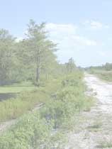
| Major Vegetation Community | |
| Vegetation Community: | Canal |
| Average Ground Elevation (ft) NAVD88: | 6.12 |
| Maximum Ground Elevation (ft) NAVD88: | 6.61 |
| Minimum Ground Elevation (ft) NAVD88: | 5.40 |
| Number of Measurements: | 5 |
| Collecting Agency and Date: | USGS, July 2007 |
| Data release: https://doi.org/10.5066/P13M7CRD | |
| Leaflet Map | |
|---|---|
|
Leaflet Map (showing location of gage Tamiami_Canal_40-Mile_Bend_to_Monroe). This map requires enabled JavaScript to view; if you cannot fully access the information on this page, please contact EDEN Data Help References to non-U.S. Department of the Interior (DOI) products do not constitute an endorsement by the DOI. |