
Everglades Depth Estimation Network (EDEN) for Support of Biological and Ecological Assessments
Ground elevation data for the greater Everglades and the DEM derived from them form the foundation for all EDEN water depth and associated ecological/hydrologic modeling.
Everglades ground elevation can vary by centimeters to tens of centimeters within a small spatial scale as a result of microtopography. In addition, ground surface elevations in peat soils can drop during droughts due to compaction as the peat dries and rise again with re-hydration in the wet season. Users are cautioned to use the EDEN data appropriately for site-specific assessments.
You can now download 10 m and 50 m resolution DEMs covering the EDEN study area with an elevation uncertainty treatment. This dataset includes a "best" as well as upper and lower elevation estimates. These DEMs address elevation error by using Monte Carlo simulations of 1,000 iterations with observations of elevation error in vegetated wetlands and assumptions error in vegetated non-wetland and non-vegetated areas. Additionally, this dataset includes accuracy information by sub-area.
Download the DEM on ScienceBase: https://doi.org/10.5066/P1XTHZ7D
Citation:
Simons, B.M., Enwright, N.M., Haider, S.M., Gann, D., Gesch, D.B., Danielson, J.J., and Cushing, W.M., 2024, Digital elevation models for the Everglades Depth Estimation Network with elevation uncertainty treatment (ver. 2.0, March 2025): U.S. Geological Survey data release, https://doi.org/10.5066/P1XTHZ7D
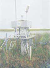
This DEM was produced using the version HAED_v01 of the HAED (High Accuracy Elevation Dataset). To learn more about the data collection and DEM development, see the "For More Information" panel to the left.
The elevation value for each EDEN 400m by 400m grid cell is a modeled value influenced by variation in the aerial height finder data surrounding the grid cell.
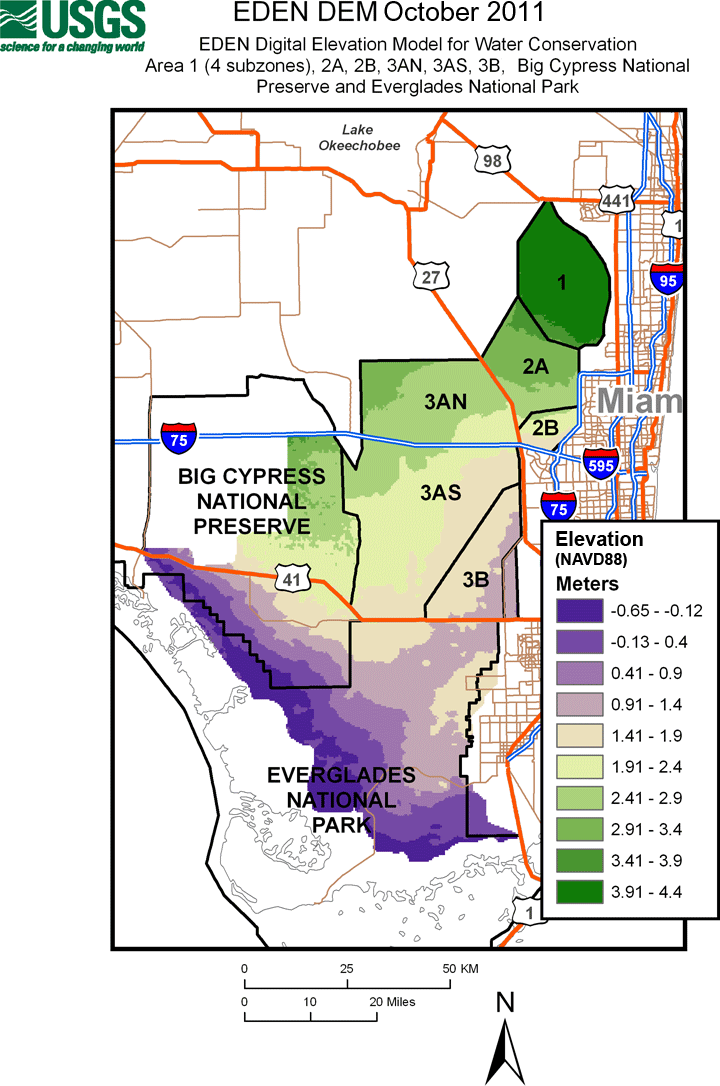
| Publication Date: October 2011 400m x 400m DEM |
|
 |
Centimeter Version (NAVD88):
Meter Version (NAVD88):
|
References:
Jones, J. W., Desmond, G. B., Henkle, C., & Glover, R., 2011, An approach to regional wetland digital elevation model development using a differential global positioning system and a custom-built helicopter-based surveying system, International Journal of Remote Sensing, 33(2), 450–465, https://doi.org/10.1080/01431161.2010.533212
Jones, J. W. and Price, S. D., 2007, Everglades Depth Estimation Network (EDEN) digital elevation model research and development: U.S. Geological Survey Open-File Report 2007-1034, 29 pgs., https://doi.org/10.3133/ofr20071034
Xie, Z., Liu, Z., Jones, J. W., Higer, A. L., and Telis, P. A., 2011, Landscape unit based digital elevation model development for the freshwater wetlands within the Arthur C. Marshall Loxahatchee National Wildlife Refuge, Southeastern Florida, Applied Geography, 31(2), 401-412, https://doi.org/10.1016/j.apgeog.2010.10.003
Please note: