Period Covered: October 1, 2009 through September 30, 2010
Project: South Florida Surface Water Monitoring Network for Support of MAP Projects Agency: U.S. Geological Survey (USGS) USGS Point of Contact: Pamela Telis, eden-data-help@usgs.gov, 904-232-2602 USACE Point of Contact: David Tipple, 904-232-1375, Gretchen Ehlinger, 904-232-1682 Agreement: USGS IA#28 under MOA between USGS and USACE
This annual report for 2010 summarizes the major accomplishments, lists of deliverables, and outlines the work plan for 2011 for the EDEN project. The EDEN's primary deliverable and product continues to be the EDENweb (http://sofia.usgs.gov eden); the project website that provides all data, results, documentation, and other project information for EDEN users.
Started development of subarea models for potential improvements of results and for scenario testing using model
Model to be finalized and documented in first quarter 2011
Continued to improve quality and efficiency of data management
Improved communication and response time with agencies for addressing problems with water-level data
Improved scripts that load, test, and verify data sets in NWIS database
GAPFILL program now processed in a SQL server for improved computing capabilities and efficiency of processing
Began testing the inferential sensor tool for daily data processing.
EDEN digital elevation model for ground surface revised and expanded in 2009 was documented with metadata and posted to EDENweb for users
The shaded polygons represent the areas of the EDEN study area for which new digital elevation models have been developed: WCA1 (4 new models), the northwest corner of ENP/southern portion of BCNP. [larger version]
Revisions to EDENapps completed, including:
Easier and consistent loading of datasets
Improved color ramps
Standardization of terms and techniques across tools
Compilation of a data library of TIME model input for 10/1/06 through 9/30/09. This data set will allow running of the TIME (now called the BISECT model) for ENP for use in the coastal EDEN analyses planned in 2011.
Support to numerous RECOVER-funded and other Everglades Investigators (examples below):
Joel Trexler, FIU – developed spreadsheet format of selected water depth data for assessment of fish datasets:
[larger version]
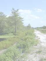
Vic Engel, ENP – Three-month mean water level surfaces for 2009 SSR:
[larger version]
EDEN Newsletter currently has 120 subscribers and is used to notify users of updates or additions to the EDEN website.
II. Significant Meetings/Workshops/Conferences
The EDEN team participated in GEER 2010 with 5 posters and 2 oral presentations (All posters are posted on EDENweb):
Roehl, E., Daamen, R., and Conrads, P., Development of Inferential Sensors for Real-time Quality Control of Water-level Data for the EDEN Network, GEER2010.
Telis, P., McCloskey, B., and Xie, Z., Using a Network of Benchmarks to Evaluate and Verify the EDEN Surface-Water Model, GEER2010.
Xie, Z., Liu, Z., Pearlstine, L., Sonenshein, R., Conrads, P., Henkel, H., and Telis, P., Revision and Assessment of Water-Surface Modeling of the Everglades Depth Estimation Network (EDEN), GEER2010.
Xie, Z., Liu, Z., Jones, J., Higer, A., Telis, P., and Conrads, P., Revisions to the EDEN Ground-Surface Digital Elevation Model and Water Surface Model in the Water Conservation Area 1, GEER2010.
UNESCO seminars
Bryan McCloskey (presenter), The South Florida Information Access (SOFIA) System and Everglades Depth Estimation Network (EDEN), June 8, 2010, Davie, FL
Community for Data Integration Workshop
Conrads, P., Xie, Z., McCloskey, B., Hindcasting Water-Surface Elevations for Water Conservation Area 3A.
Henkel, H. and McCloskey, B., Everglades Depth Estimation Network (EDEN): How the Right Mix of Scripts, Programs and Databases Can Create Better Maps, Data, and Tools.
Higer, A., Conrads, P., Henkel, H., Telis, P., and McCloskey, B., Conceptual Components for the Coastal Everglades Depth Estimation Network (Coastal EDEN).
Other conferences
3rd USGS Modeling Conference -- Revision and Assessment of Water-Surface Modeling of the Everglades Depth Estimation Network (EDEN).
2010 South Carolina Water Resources Conference -- New approved paper will be presented in October -- Daamen, R.C., Roehl, E.A., and Conrads, P.C., 2010, Development of Inferential Sensors for Real-time Quality Control of Water-level Data for the Everglades Depth Estimation Network: Proceedings of the 2010 South Carolina Water Resources Conference, held October 13-14, 2010, at the Columbia Metropolitan Convention Center.
III. Administrative (Contractual and Budgetary)
The previous agreement, USGS IA#12 under MOA between USGS and USACE, ended 3/31/10. A final report delivered on 3/18/10 documented all deliverables for that agreement.
A new agreement, USGS IA# 28 under the MOA between USGS and USACE, started 4/1/10 for the period 4/1/10 through 3/31/15.
University of Florida (UF, Aaron Higer) and Florida Atlantic University (FAU, Zhixiao Xie, Zhongwei Liu) were funded by the EDEN project through a CESU agreement in FY10 for:
Revision/documentation of the EDEN surface water interpolation program
Compilation of TIME datasets for the period 2007-2009.
IV. Support from other Programs and Funding Sources
The RECOVER Evaluation Team funded (FY2010) the compilation of data for creation of hindcasted water level data and generation of EDEN surfaces prior to 2000 back to 1990 for the EDEN domain. Effort to be completed 3/31/11. Figure below shows preliminary results for WCA3A-South.
[larger version]
Greater Everglades PES funds continue to support the EDEN project by funding efforts by Paul Conrads (USGS-SC), John Jones (USGS-Reston), Heather Henkel (USGS-St. Pete), and Bryan McCloskey (USGS-St. Pete). Additionally, PES provides some funds for Pamela Telis (USGS-Jacksonville) in her role as project coordinator and liaison with the USACE.
ARRA (economic stimulus) funding (June 2009 through Sept 2010) supported an effort by Advanced Data Mining (ADM), LLC to address data quality issues by developing an intelligent software application to automate the validation and correction of data, in the case of EDEN, prior to creation of the daily water level surfaces. Additionally, the ARRA funding partially supported the CESU agreement with Florida Atlantic University to improve the surface water interpolation program based on the improved datasets based on ADM's effort. The final report for this effort is due 9/30/10.
USACE funding paid to install and survey a network of benchmarks throughout the Everglades, collect water level data at this network (during wet season 2009, dry season 2010, and wet season 2010), install continuous water level recorders at benchmarks in Everglades National Park, survey elevations to NAVD88 datum at 8 water level gages in Everglades National Park, and collect ground elevation data at 12 water level gages. The EDEN project used these data to improve the quality of the EDEN daily water level surfaces.
V. FY10 Deliverables/Reports
EDENweb has been updated throughout the year to provide data, metadata, and documentation to MAP PIs and others.
Report (partially funded by USGS PES funds):
Xie, Z., Liu, Z., Jones, J., Higer, A., and Telis, P., Landscape Unit Based Digital Elevation Model Development in the Freshwater Wetlands of Southeastern Florida, submitted to the Journal of Applied Geology, September 2010.
For the 2009 System Status Report, EDEN provided hydroperiod maps and mean monthly water depth data to assist with hydrologic assessments of component areas of the Everglades and for understanding the total system hydrology. Then in July 2010, the SSR review team asked that EDEN prepare additional maps that show contours of the water surface elevation and flow directions through the EDEN domain during wet and dry conditions. See example above.
VI. FY11 Workplan
Data management and daily water surface creation
Create and post daily water surfaces on schedule
Implement automated data assurance and estimation program
Use new datum surveys at gages to revise water level data
Add new gages if appropriate
Implement rules for handling 'dry' data at gages and in EDEN surfaces
Complete revision of surface-water model
Use water level data at benchmarks to evaluate/improve EDEN surfaces
Consider collaboration with National Wetlands Research Center for revisions to EDENapps
Conduct hydrologic assessments for RECOVER
Continue to document EDEN protocols, research, and data analyses
VII. Anticipated Needs or Issues
The needs/issues reported in the 2009 Annual Report are still relevant and of concern to the EDEN project team. See bullets below.
Because the water level data at gages is the foundation of the EDEN surface water interpolation program, the quality of gage data is critical to the resultant EDEN daily water surfaces. Gage data used for EDEN surfaces comes from multiple agencies with varying protocols, schedules, and levels of review. It is a highly ambitious goal to receive hourly data from 230 gages daily (approximately 5520 data values). Even if only 1% (rarely this low) of these data appear bad or are missing, 55 values per day or 5000 values per quarter must be identified and resolved. Monitoring, reviewing, editing (when necessary) and estimating missing and bad data has taken more personnel time than expected. Users see the results as EDEN products when, in fact, they are the result of many others' work outside of EDEN. It has been a serious challenge for me as the project chief to balance sufficient data quality with adequate results and appropriate use of funds.
EDEN staff continues to be concerned that datum surveys and water level data is not as accurate as necessary to produce a high-quality interpolated water-level surface. Independent data sets at gages may look adequate but when surfaced together can show discontinuities and shifts not seen when viewing water level data gage by gage. Continued investigation of data and files suggests that gage data may still have datum inaccuracies. New funding in 2011 may be available to run new datum surveys to the newest standards for many gages in the Everglades. Any significant changes to the water level dataset might require another round of reparameterizing of the surface water model.
VIII. Funding Status
As of 9/30/10, part of the FY10 funding under the new agreement has been expended or obligated. The remaining for the hindcasting effort will be expended by 3/31/11 as per the agreement.
ARRA (economic stimulus) funding was received 6/29/09 and is fully expended as of 9/30/10.
USGS Priority Ecosystem Science (PES) funding in FY2010 was to multiple principal investigators in support for EDEN research efforts. This level of support is expected to be continued in FY2011.
Technical support for this Web site is provided by the U.S. Geological Survey This page is:
https://sofia.usgs.gov/eden/annual-rpt/status-annrpt10.php Comments and suggestions? Contact: EDEN Data Help Last updated:
March 06, 2025 06:59 PM (BJM)