
Please note: a newer version of this file is available
| January 2010 EDEN Digital Elevation Model (DEM) | |
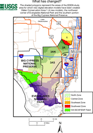 Map highlighting areas with new digital elevation models [larger version] |
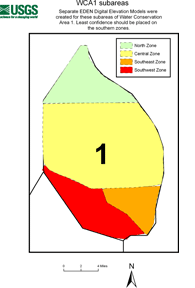 WCA1: Map showing location of four new models [larger version] |
|
What has changed? The shaded polygons in the maps above represent the areas of the EDEN study area for which new digital elevation models have been created:
|
|
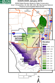 |
Download EDEN_EM_JA10 Files:
NOTE: THIS DEM FILE REPLACES EDEN_EM_OCT07 |
This DEM was produced using the version HAED_v01 of the HAED, all available aerial height finder (AHF) data points posted to the SOFIA website as of October 2007. To create a realistic region-wide elevation model for EDEN purposes, the elevation data were segregated by Water Conservation Areas and National Park boundaries so that local trends could be isolated, sub-region specific interpolation models could be developed, and realistic breaks in elevation along sub-region boundaries could be imbedded in a final, region-wide DEM. To-date, the best performing DEMs for all subareas have been produced using the geostatistical approach called "anisotropic ordinary kriging".
The ground elevation, and therefore water depth, in the Everglades can vary by centimeters or tens of centimeters within a few meters of a given location as a result of microtopographic features. In addition, ground surface elevations in the peat soils of the Everglades can drop during droughts due to compaction as the peat dries and can rise again in the wet season with re-hydration. The elevation value for each EDEN 400m by 400m grid cell is a modelled value influenced by variation in the AHF data surrounding the grid cell. Users are cautioned to use the EDEN data appropriately for site-specific assessments.
| Archived File: EDEN_EM_OCT07 | |
|---|---|
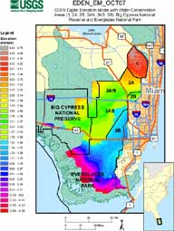 |
Download EDEN_EM_OCT07 Files:
NOTE: THIS DEM FILE REPLACES EDEN_EM_JAN07 and has been replaced by EDEN_EM_JA10 |
Please note: The grid used to break up the EDEN area into equal-sized rectangles ("cells") is at a 400m by 400m resolution. While previous releases of the EDEN DEM were produced at a resolution of 60m by 60m to facilitate satellite-based research, this DEM was produced at 400m by 400m resolution and positioned to match the spatial referencing of the EDEN grid. Also note that the EDEN_EM_OCT07 file is at meter resolution, while EDENapps tools are at centimeter resolution and require a different version of the DEM. Download the EDENapps DEM directly or visit any of the EDENapps pages to download this file.
The released January 2010 data was modified in two ways.
| EDENapps January 2010 Digital Elevation Model (DEM) |
||
January 2010 |
January 2010 |
Map Showing Coverage of January 2010 |
|---|---|---|
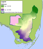 EDENapps DEM coverage (pink area is the current EDEN surface water domain with no DEM) [larger version] |
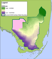 EDEN DEM coverage (pink area is the current EDEN surface water domain with no DEM) [larger version] |
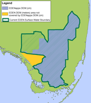 Both DEMs with current EDEN surface water boundary [larger version] |
|
Download:
|
||
EDENapps DEM file for ground elevation (.zip, 170 KB)
For more information, see "Initial Everglades Depth Estimation Network (EDEN) Digital Elevation Model Research and Development" (USGS Open File Report 2007-1034) and the ground elevation model release log, or contact John Jones.
